
Case Studies
A selection of current research projects:

Woody Regrowth
Identifying regrowth from remotely sensed data is highly desired, the applications are currently focussed on supporting State Government activities/legislation but the potential may be far broader, extending to land managers and those interested in identifying vegetation change or biomass.

Spatial BioCondition
Scientists from the Department of Environment and Science are developing, in collaboration with Dr Leonardo Hardtke from the Joint Remote Sensing Research Program, a spatial modelling framework to map state-wide vegetation condition for biodiversity for the Queensland Government.

Lidar
Research is enabling airborne and terrestrial lidar archives to be utilised and transformed into operational products. This is done by developing code to process lidar point clouds efficiently into standard raster datasets, thereby saving time and making data more discoverable and easily integrated into spatial systems.

Seasonal Cover Disturbance Index and Image (SCDI)
Seasonal Cover Disturbance Index/Image assists in identifying areas of grassland modification. The importance of this product has become increasingly evident since protection of native grasslands became recognised within State vegetation legislation and subsequently the need for reliable methods of detection.
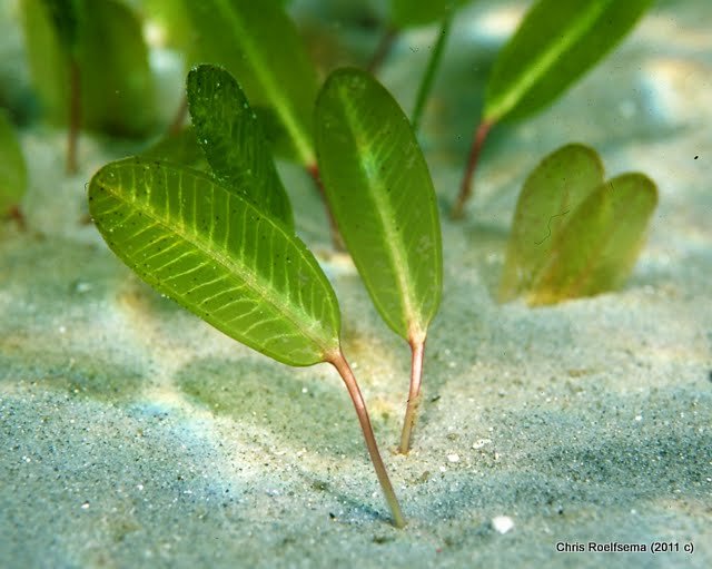
Seagrass Mapping
The pilot research project occurring in the Morten Bay region is developing methods and processes to map seagrass extent and percentage cover. This will assist natural resource and environmental managers to report on condition and quality and develop management plans and policies based on reliable data.
